

Projecting a geographer's life
Projecting a geographer's life
Gerardus Mercator accumulated and innovated and was not murdered

Napoleon may be burning up the box office, but Nicholas Crane offers a slightly less “sexy” hero: Gerard Mercator, father of the Mercator projection, and one of the all-time greats of mapmaking. Just imagine a Broadway musical (Mercator!) about a damp orphan studying ancient cosmography. He overcame that background to become a damp adult who studied contemporary geography!
Crane’s book has a faint comedy due to the sedentary nature of our hero’s achievements. Mercator became a great geographer through detailed correspondence and painstakingly compiling reliable information. He didn’t sail anywhere. He didn’t do any swashbuckling. A trip to the hissing wilderness of Lorraine almost killed him. And so the biographer details Mercator’s movements around the marshes of his native Low Countries, dodging persecution by Spanish imperialists.
Intellectual labor in those days took place amidst intense deference to clerics and to the great ancient symmetry-obsessed astrologer Ptolemy. The feedback Magellan’s crew came home with from their trip around the world was thoroughly mediated by the church. Mercator relies more on the tales related by English mariners, and thus had to rely on soft-science skills of evaluating reliability from these salty types. Some of the tips for the placement of landmasses came from folk songs. The reader learns to appreciate the idiosyncratic ways that knowledge of the Earth has advanced. Mercator’s was a “consensual geography” of accumulated wisdom, carefully displayed.

Mercator put his outstanding penmanship to use by mastering a new writing style imported from Italy called “italics.” Tilting the letters allowed him to pack more data closer together. Labeling rivers and towns clearly was particularly important before Mercator came up with the custom of denoting political entities in different colors. Mapmakers had for a long time subtly underemphasized the gaps in their knowledge by festooning their creations with drawings of creatures, and carefully placing title tableaus over terra incognita. A globemaker didn’t have this luxury though, and Mercator endeavored to map the whole world, and not fudge anything with sea monsters or the type of conjecture that unites Argentina with Antarctica.
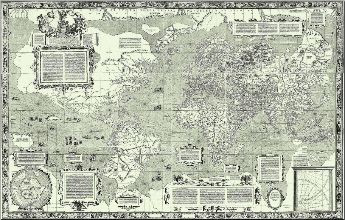
Crane doesn’t spend much time on the 1569 projection that makes Greenland look so much bigger than the Congo (even though Greenland is actually smaller). Unspooling a three dimensional surface onto a two dimensional map requires distortions that for me are aesthetic problems, but at the time were navigation issues that could send sailors spiraling poleward. Swollen northern landmasses made Mercator a household name, but I’m glad the book didn’t dwell on that process. Political oppression at the hand of clerics and Habsburg imperialists makes for juicier reading than mathematical problems.
The adventures of the Age of Discovery took place on the high seas, but the knowledge was compiled in Benelux. Huge, potentially fictional islands had to be moved or deleted from existence when Mercator sat down to his work. More difficult than observing and recording the physical reality of the Earth was making sure that the authorities didn’t strangle and burn you for heresy, as befell some of Mercator’s contemporaries. May the cause of “humanism” prevail.
Further Reading:
Joaquim Alvares Gaspar and Henrique Leitão, “How Mercator Did it in 1569: From Tables of Rhumbs to a Cartographic Projection,” Newsletter of the European Mathematical Society, pp. 44-49, March 2016.
Nicholas Crane, Mercator (2003).